Fixed point ocean observatory at Chiba Lighted Beacon
Outline of Monitoring Post
Objective
Monitoring Post continuously monitors water temperature, salinity, dissolved oxygen, chlorophyll-a, turbidity, flow direction flow velocity, wind direction wind speed at the lighted beacon in the Tokyo Bay. Observation data obtained by the Fixed point ocean observatory at Chiba Lighted Beacon are used for elucidating the contamination mechanism and evaluating the effect of environmental regeneration measures.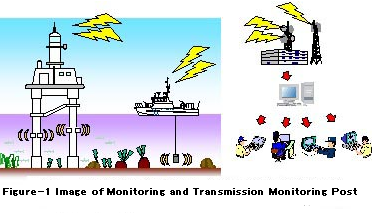
Location of monitoring post
Monitoring Post is installed in the Chiba Lighted Beacon( 35-34-05N, 140-02-45E, about 5 km southwest of Chiba Port)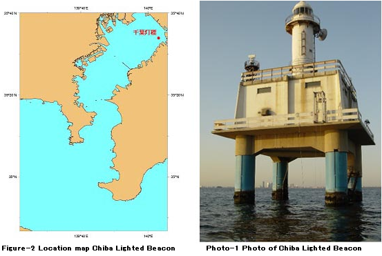
System configuration of monitoring post
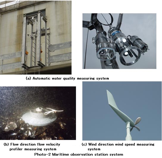
Monitoring post is configured with two systems of the maritime observation station system installed in the Chiba Lighted Beacon and the land communication analyzer installed in the Hydrographic and Oceanographic Department of Japan Coast Guard.Automatic lifting water quality measuring system, flow direction/flow velocity profiler measuring system, wind direction/wind speed measuring system are equipped in the maritime observation station system.
Water temperature, salinity, dissolved oxygen, chlorophyll-a, flow direction/flow velocity of currents and wind direction/wind speed of ocean wind are continuously observed.
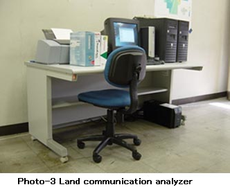
Land communication analyzer saves the observation data transmitted from the maritime observation station in the database and creates a picture to make it easy for understanding of the public user.
* JODC provides observed data only, doesn’t provide pictures. If you want pictures, please contact JHOD.
Observation Item・Observation Interval
Monitoring post observes 7 items continuously of water temperature, salinity, dissolved oxygen, chlorophyll-a, turbidity, flow direction/flow velocity of currents, wind direction/wind speed of the ocean wind by the 3 observation systems of automatic lifting water quality measuring system, flow direction/flow velocity profiler measuring system, wind direction/wind speed measuring system.Automatic lifting water quality measuring system observes oceanographic data (depth, water temperature, salinity, dissolved oxygen, chlorophyll-a, turbidity) with lifting the system automatically from the sea level to the sea floor once in an hour (every hour on the hour) at an interval of 1m.
Flow direction/flow velocity profiler measuring system observes data of flow direction/flow velocity of every1m layer once in an hour (every hour on the hour) with an ultrasonic Doppler profiler.
Flow direction/flow velocity is recorded as an average value data of one minute.
Wind direction/wind speed measuring system observes the maximum wind direction/wind speed and the average wind direction/wind speed of 10 minutes every 15 minutes with an anemometer approved by the Meteorological Agency.
Note: There may be missing data, observation intervals may not be continuous.