Click each chart and you can see the extended chart.
J-EGG500(JODC-Expert Grid data for Geographic -500m)
JODC-Expert Grid data for Geography(J-EGG500) is a 500m gridded bathymetric data set. A huge amount of the depth-sounding survey data around Japan, which were taken by HOD and also various ocean research institutes, have been integrated and gridded by 500m intervals to be used for general purposes.
Since variety of data quality and variety of data density exist, smoothing operation was applied to the data including the areas where observed data exist, in order to avoid improper steps caused by the quality difference. This may results in neglect of small undulations.
Moreover, in the areas where no observed data exist or bathymetry changes rapidly such as coastal areas or seamounts, there are cases where adopted values are fairly different from observed values.
Please use data taking these into consideration.
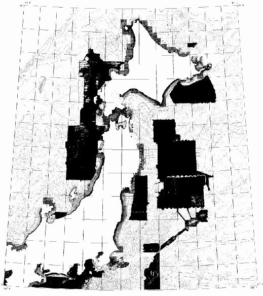
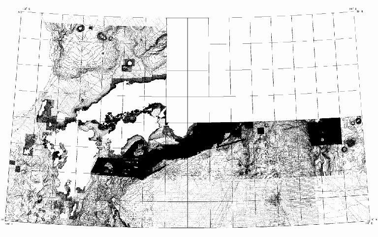
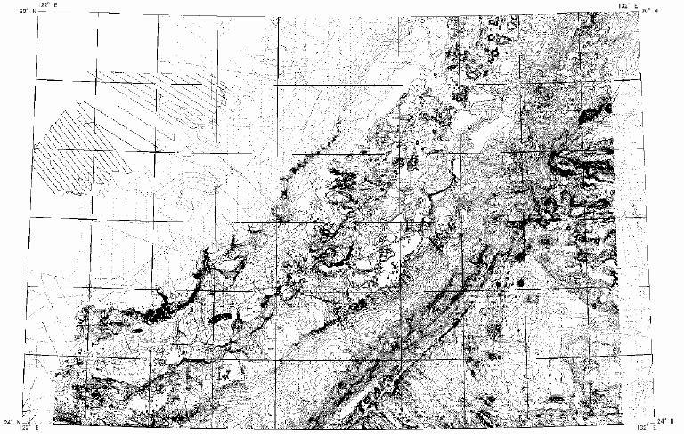
The data set includes three areas as following.
(DATA: WGS-84)
Area
(1) latitude: N 34 to 46 (degrees), longitude : E 135 to 148 (degrees)
(2) latitude: N 30 to 38 (degrees), longitude : E 128 to 144 (degrees)
(3) latitude: N 24 to 30 (degrees), longitude : E 122 to 132 (degrees)
Data format
The data are described by ASCII character with following format.
I1, F10.5, F10.5, I6 [Flag (0 or 1), Latitude (Deg.), Longitude (Deg.), Depth (m)]
Note; Flag "0" means the measured depth(averaged value),
and "1" means the interpolated depth.
The following charts show the points of measurements for three
areas.
Click each chart and you can see the extended chart.
![[search]](/jodc-image/access.gif) Click this button to access to the database
Click this button to access to the database
Last update: October 3, 2005